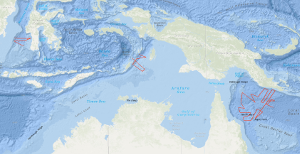
The results of the 1978 SONNE survey by the Federal Institute for Geosciences and Natural Resources (BGR), in the Coral Sea indicated the presence of narrow rift valleys beneath the outer margins of the Queensland and Papuan Plateaus. On the margins of these valleys, features were observed which were then interpreted to be large fossil reefs underlying an Eocene/Oligocene unconformity. These conclusions were important because they indicated that the Coral Sea Basin region is ideal for research into the fundamental problems concerning the development of continental margins. That is, the region offers similar problems to areas of the world where detailed studies are currently being conducted (e.g. West African margin) but with less complicated superimposed structure and a much thinner sediment cover. During the period from 29th November 1980 to 9th January 1981 a 'follow up' survey on the first and second leg of cruise SO-16 using the R/V SONNE was carried out in the northern Coral Sea, around the margins of the Coral Sea Basin, by the BGR in co-operation with the Bureau of Mineral Resources, Geology and Geophysics, Canberra (BMR) and the Geological Survey of Papua New Guinea, Port Moresby (GSPNG). The survey, which was divided into a geophysical cruise (first leg of SO-16) and a geological sampling cruise (second leg of SO-16), resulted in the recording of about 7,140 km of bathymetric and gravimetric data, of about 6,950 km of magnetic data, 3,150 km of digital multichannel seismic reflection profiles, 3,560 km of analogue single channel seismic reflection profiles, 10 sonobuoy refraction profiles and the sampling of 16 stations by dredging and 9 by coring. In the period from 9th January to 6th February 1981, geophysical investigations on the 3rd leg of SONNE cruise SO-16 were carried out in the Arafura Sea between Tanimbar, Aru and Kai Islands, and in the southern part of the Makassar Strait by BGR in co-operation with the Geological Research and Development Centre, Dept. Mines and Energy of Indonesia, Bandung and the Indonesian lnstitute of Sciences (LIPI), Bandung. 4,060 km of bathymetric and gravity lines, 3,080 km of magnetic lines, 1,415 km of reflection seismic lines (digital and analogue), and 9 sonobuoy profiles were recorded during this leg. Objectives of the Arafura Sea survey were determination of (a) thickness, seismic pattern, tectonic style and subsidence of the Cenozoic/Mesozoic depositional sequences at the transition from the Australian continental shelf to the Tanimbar outer arc ridge and (b) the configuration of the Precambrian rocks of the above mentioned transition zone. Objectives of the Makassar Strait survey were determination of (a) the nature and configuration of the acoustic basement underlying the South Makassar Basin, (b) the formation and nature of the sediments overlying the acoustic basement, (c) the regional distribution of a major unconformity of assumed Middle Miocene age as observed on profile VA16-24 of the VALDIVIA cruise VA-16 in 1977 in order to get a better understanding of the development of the South Makassar Basin. Auf dem ersten und zweiten Fahrtabschnitt der Fahrt SO-16 vom 22.11.1980 bis zum 09.01.1981 mit dem Forschungsschiff SONNE sind 7.140 km bathymetrische und gravimetrische Messungen, 6.950 km magnetische Messungen, 3.560 km analogseismische Messungen, 3.150 km digitalseismische Messungen, 10 Sonobojenmessungen sowie 10 Dredge-Stationen und 9 Schwerelot-Stationen durchgeführt worden. Es gelang, die beiden bedeutenden Unkonformiten eozänen/oligozänen und mittelmiozänen Alters fast über das gesamte Untersuchungsgebiet hinweg seismisch zu erfassen. Die Natur des Basements konnte in den wichtigsten Bereichen aufgrund seismischer, struktureller und magnetischer Charakteristika bestimmt werden. Eine reiche Ausbeute geologischer Proben stützt einige aus der bisherigen Auswertung hervorgegangenen Hypothesen, insbesondere die Deutung des Queensland Plateaus als Kontinentalfragment. Auf dem dritten Fahrtabschnitt der Fahrt SO-16 vom 09.01.1981 bis zum 06.02.1981 sind 4.060 km bathymetrische und gravimetrische Messungen, 3.880 km magnetische Messungen, 1.415 km reflexionsseismische Messungen (analog und digital) und 9 Sonobojenmessungen durchgeführt worden. Die seismischen Messungen verteilten sich auf die Gebiete Arafura Sea (765 km) und Makassar Strait (650 km). Im Messgebiet Arafura Sea konnten bis zu 5 km mächtige Sedimentlagen über kontinentalem Basement nachgewiesen werden. Im Messgebiet Makassar Strait konnte ebenfalls das gesamte Sedimentpaket mit bis zu 5 sec Reflexionszeit-Intervall über Basement ozeanischen Typs erfasst werden.


