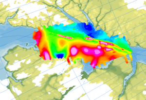
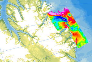
During the German-Canadian Nares Strait Expedition in 2001, an aeromagnetic survey was carried out across the northern part of the Nares Strait including the Hall Basin, Judge Daly Promontory and in Robeson Channel in cooperation with the Canadian GSC. The aim of the research was to detect and localize the Wegener Fault, a transform fault between Ellesmere Island and NW Greenland, which is closely linked to the opening of the North Atlantic and the Arctic Ocean. The helicopter-borne magnetic survey NARES I (Robeson Channel) was carried out with a flight line spacing of 2 km, and control profiles were flown every 10 km. During the expedition, 5470 km of line data were collected. The aeromagnetic data were recorded by a magnetometer, which was towed approx. 25 m beneath the helicopter and recorded at a constant altitude of 305 m (1000 ft) above ground. Im Rahmen der Expedition NARES I wurde während der deutsch-kanadischen Nares Strait-Expedition 2001 ein aeromagnetisches Messprogramm über der nördlichen Nares Straße, welches das Hall Basin, Judge Daly Promontory und den Robeson Channel abdeckt, in Kooperation mit dem kanadischen GSC durchgeführt. Ziel der Forschungsarbeiten waren der Nachweis und die Lokalisierung der Wegener-Transformstörung, die zwischen Ellesmere Island und Nordwest-Grönland vermutet wird und eng mit der Öffnung des Nordatlantiks und des Arktischen Ozeans verknüpft ist. Die helikoptergestützte magnetische Befliegung NARES I (Robeson Channel) wurde mit einem Fluglinienabstand von 2 km durchgeführt, und alle 10 km wurden Kontrollprofile geflogen. Während der Expedition wurden 5470 km Liniendaten erfasst. Die aeromagnetischen Daten wurden durch eine ca. 25 m unter dem Helikopter hängende Sonde gewonnen bei einer Konstanten Flughöhe mit 305 m (1000 ft) über Grund aufgezeichnet.
Raumbezug
Lage der Geodaten (in WGS84)
| SW Länge/Breite | NO Länge/Breite | |
|---|---|---|
| -69.01°/80.42° | -59.9°/82.21° |
| Koordinatensystem |
|---|
Verweise und Downloads
Downloads (2)
AeromagNARES (GeoTIFF)
AeromagNARES im Format geoTiff
Flightlines (Shape)
Flightlines im Format Shape
Querverweise (1)
WMS
Geodatendienst
Helicopter-borne Magnetics in the Arctic region (WMS)
The study of the geodynamic evolution of the Arctic continental margin and opening of the Arctic Ocean represents a primary target of BGR research and is studied within the frame of the CASE programme. In addition to onshore geological investigations, BGR conducts airborne aeromagnetic surveys. The available service contains the results of aeromagnetic surveys from the CASE program as well as cooperation projects (PMAP, NARES & NOGRAM), which were obtained with helicopters or fixed-wing aircraft in the Arctic.
Kartenansicht öffnen
Weitere Verweise (2)
https://services.bgr.de/geophysik/aeromagarctic
Information
Karte im BGR-Geoviewer
https://www.bgr.bund.de/DE/Themen/Polarforschung/Projekte/Arktis_abgeschlossen/nares_strait.html
Information
Geowissenschaftliche Erforschung der Nares Strait
| Identifikator des übergeordneten Metadatensatzes |
e85d6dcc-91b8-48bc-a80d-7ca0f9546cda |
|---|
Nutzung
| Nutzungsbedingungen |
Allgemeine Geschäftsbedingungen, siehe https://www.bgr.bund.de/AGB - General terms and conditions, see https://www.bgr.bund.de/AGB_en. Die bereitgestellten Informationen sind bei Weiterverwendung wie folgt zu zitieren: Datenquelle: AeromagNARES, (c) BGR, Hannover, 2023 |
|---|
| Zugriffsbeschränkungen |
no limitations to public access |
|---|
Kontakt
Fachinformationen
Informationen zum Datensatz
| Identifikator |
d9eb00fe-93f2-ee92-1102-eb9081d484c4 |
|---|
| Fachliche Grundlage |
The aeromagnetic data were collected by GSC Canada and BGR as part of the NARES I expeditions between Ellesmere Island and NW Greenland. |
|---|
Zusatzinformationen
| Sprache des Datensatzes |
Englisch |
|---|
Datenformat
| Name | Version | Kompressionstechnik | Spezifikation |
|---|---|---|---|
| GeoTIFF | n/a | ||
| shp | n/a | ||
| WMS | OGC:WMS1.3.0 |
Schlagworte
| INSPIRE-Themen | Geology |
| GEMET-Concepts | Geophysik |
| ISO-Themenkategorien | Geoscientific Information |
| Suchbegriffe | Aerogeophysik Aeromagnetik Airborne geophysics Anomalien des erdmagnetischen Feldes anomalies of the Earth’s magnetic field Arctic Arktis helicopter-borne /fixed-wing magnetics Nares Strait Nordpolargebiet |
Informationen zum Metadatensatz
| Objekt-ID |
6a024df8-519d-48c6-baf3-1fb71b071b85 |
|---|
| Aktualität der Metadaten |
07.04.2025 |
|---|
| Sprache Metadatensatz |
Englisch |
|---|
| Datensatz / Datenserie |
Dataset |
|---|
| XML Darstellung |
|---|
| Point of Contact (Metadatum) |
|---|
| Metadatenquelle |
GeoDaK (Datenkatalog der Bundesanstalt für Geowissenschaften und Rohstoffe)
|
|---|---|
|
ni_bubgr
|


