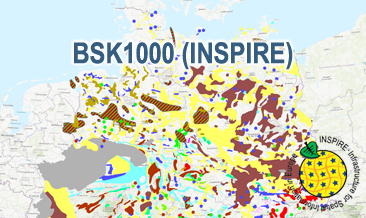
The BSK1000 (INSPIRE) provides the basic information on the spatial distribution of energy resources and mineral raw materials (‘stones and earth’, industrial minerals and ores) in Germany on a scale of 1:1,000,000. The BSK1000 is published by the Federal Institute for Geosciences and Natural Resources in cooperation with the State Geological Surveys of Germany. According to the Data Specification on Mineral Resources (D2.8.III.21) the content of the map is stored in five INSPIRE-compliant GML files: BSK1000_Mine.gml contains important mines as points. BSK1000_EarthResource_point_Energy_resources_and_mineral_raw_materials.gml contains small-scale energy resources and mineral raw materials as points. BSK1000_EarthResource_polygon_Distribution_of_salt.gml contains the distribution of salt as polygons. BSK1000_EarthResource_polygon_Energy_resources.gml contains large-scale energy resources as polygons. BSK1000_EarthResource_polygon_Mineral_raw_materials.gml contains large-scale mineral raw materials as polygons. The GML files together with a Readme.txt file are provided in ZIP format (BSK1000-INSPIRE.zip). The Readme.text file (German/English) contains detailed information on the GML files content. Data transformation was proceeded by using the INSPIRE Solution Pack for FME according to the INSPIRE requirements. Die BSK1000 (INSPIRE) liefert grundlegende Informationen zur räumlichen Verteilung von Energierohstoffen und mineralischen Rohstoffen (Steine und Erden, Industrieminerale und Erze) in Deutschland im Maßstab 1:1.000.000. Die BSK1000 wird von der Bundesanstalt für Geowissenschaften und Rohstoffe in Zusammenarbeit mit den Staatlichen Geologischen Diensten herausgegeben. Entsprechend der Datenspezifikation Mineral Resources (D2.8.III.21) liegen die Inhalte der Karte in fünf INSPIRE-konformen GML-Dateien vor: BSK1000_Mine.gml beinhaltet wichtige Abbaustellen als Punkte. BSK1000_EarthResource_point_Energy_resources_and_mineral_raw_materials.gml beinhaltet kleinflächige Energierohstoffe und mineralische Rohstoffe als Punkte. BSK1000_EarthResource_polygon_Distribution_of_salt.gml beinhaltet Verbreitungsgebiete von Salzen als Flächen. BSK1000_EarthResource_polygon_Energy_resources.gml beinhaltet großräumige Energierohstoffe als Flächen. BSK1000_EarthResource_polygon_Mineral_raw_materials.gml beinhaltet großräumige mineralische Rohstoffe als Flächen. Die GML-Dateien werden zusammen mit einer Readme.txt-Datei im ZIP-Format (BSK1000-INSPIRE.zip) bereitgestellt. Die Readme-Textdatei (Deutsch/Englisch) enthält Detailinformationen zum Inhalt der GML-Dateien. Die Datentransformation erfolgte entsprechend der INSPIRE-Vorgaben mit dem INSPIRE Solution Pack for FME.
Raumbezug
Lage der Geodaten (in WGS84)
| SW Länge/Breite | NO Länge/Breite | |
|---|---|---|
| 5.5°/47.17° | 15.5°/55.0° |
| Koordinatensystem |
|---|
Verweise und Downloads
Querverweise (2)
predefined ATOM
Geodatendienst
Download Service (predefined ATOM) der Bundesanstalt für Geowissenschaften und Rohstoffe (BGR)
Dieser Downloaddienst stellt die von INSPIRE betroffenen und die INSPIRE-konformen Produkte der Bundesanstalt für Geowissenschaften und Rohstoffe (BGR) bereit.
WMS
Geodatendienst
INSPIRE: Map of Mineral Resources of Germany 1:1,000,000 (BSK1000) (WMS)
The WMS BSK1000 (INSPIRE) provides basic information on the spatial distribution of energy resources and mineral raw materials (‘stones and earth’, industrial minerals and ores) in Germany on a scale of 1:1,000,000. The BSK1000 is published by the Federal Institute for Geosciences and Natural Resources in cooperation with the State Geological Surveys of Germany. According to the Data Specification on Mineral Resources (D2.8.III.21) the map provides INSPIRE-compliant data. The WMS BSK1000 (INSPIRE) contains five layers: MR.Mine displays important mines. MR.MineralOccurence.Commodity.Point.EnergyResourcesAndMineralRawMaterials displays small-scale energy resources and mineral raw materials as points. MR.MineralOccurence.Commodity.Polygon.DistributionOfSalt displays the distribution of salt. MR.MineralOccurrence.Commodity.Polygon.EnergyResources displays large-scale energy resources as polygons. MR.MineralOccurrence.Commodity.Polygon.MineralRawMaterials displays large-scale mineral raw materials as polygons. The user obtains detailed information on the mineral raw materials, energy resources and mines via the getFeatureInfo request. Notes regarding the portrayal: The colouring of the large- and small-scale energy resources and mineral raw materials as well as of the mines corresponds largely to the colouring of the KOR250 respectively KOR250 (INSPIRE). In addition, the gas and oil polygons are coloured in green and red according to common international practice. The black coal polygons are displayed in their original colour grey. Also the colours of the mine symbols correspond largely to the KOR250 respectively KOR250 (INSPIRE) colouring. Only the salt and potash mine symbols have their original colour. All mine symbols are BGR symbols. The distribution areas of the Triassic and Zechstein salt show the corresponding geochronological INSPIRE colours (see Data Specification on Geology D2.8.II.4_v3.0). The distribution area of salt diapirism is displayed in a BGR colour.
Kartenansicht öffnen
Weitere Verweise (2)
https://services.bgr.de/inspire/bsk1000
Information
Karte im BGR-Geoviewer
https://www.bgr.bund.de/EN/Themen/Sammlungen-Grundlagen/GG_geol_Info/Karten/Deutschland/Bodenschatzkarte/bodenschatzkarte_node_en.html
Information
BSK1000-Internetseite - BSK1000-Website
Nutzung
| Nutzungsbedingungen |
Nutzungsbestimmungen für die Bereitstellung von Geodaten des BundesQuellenvermerk: Quelle: Bundesanstalt für Geowissenschaften und Rohstoffe (BGR) General Terms and Conditions, s. https://www.bgr.bund.de/agb_en Dieser Datensatz kann gemäß der "Nutzungsbestimmungen für die Bereitstellung von Geodaten des Bundes" (https://sg.geodatenzentrum.de/web_public/gdz/lizenz/geonutzv.pdf) genutzt werden. |
|---|
| Zugriffsbeschränkungen |
no limitations to public access |
|---|
Kontakt
Fachinformationen
Informationen zum Datensatz
| Digitale Repräsentation |
Vector |
|---|
Erstellungsmaßstab
| Maßstab 1:x |
1000000 |
|---|
| Fachliche Grundlage |
The BSK1000 (INSPIRE) GML files are based on the spatial dataset of the Map of Mineral Resources of Germany 1:1,000,000 (BSK1000) transformed according to INSPIRE. |
|---|
Zusatzinformationen
| Sprache des Datensatzes |
Englisch |
|---|
Konformität
| Spezifikation der Konformität | Spezifikationsdatum | Grad der Konformität | Geprüft mit |
|---|---|---|---|
| VERORDNUNG (EG) Nr. 1089/2010 DER KOMMISSION vom 23. November 2010 zur Durchführung der Richtlinie 2007/2/EG des Europäischen Parlaments und des Rates hinsichtlich der Interoperabilität von Geodatensätzen und -diensten | 08.12.2010 | See the referenced specification | |
| INSPIRE Data Specification on Mineral Resources - Technical Guidelines | 10.12.2013 | See the referenced specification | |
| INSPIRE Data Specification on Geology - Technical Guidelines | 10.12.2013 | See the referenced specification |
Datenformat
| Name | Version | Kompressionstechnik | Spezifikation |
|---|---|---|---|
| INSPIRE-GML | n/a |
Schlagworte
| INSPIRE-Themen | Mineral resources |
| INSPIRE - Räumlicher Anwendungsbereich | National |
| ISO-Themenkategorien | Geoscientific Information |
| HVD-Kategorie | Erdbeobachtung und Umwelt |
| Suchbegriffe | black coal building material clay coal crude oil Deutschland energy energy resource energy source energy source material |
Informationen zum Metadatensatz
| Objekt-ID |
e2ea5cd4-87f4-4751-980a-3451fe2f5758 |
|---|
| Aktualität der Metadaten |
10.04.2024 |
|---|
| Sprache Metadatensatz |
Englisch |
|---|
| Datensatz / Datenserie |
Dataset |
|---|
| XML Darstellung |
|---|
| Point of Contact (Metadatum) |
|---|
| Metadatenquelle |
GeoDaK (Datenkatalog der Bundesanstalt für Geowissenschaften und Rohstoffe)
|
|---|---|
|
ni_bubgr
|


