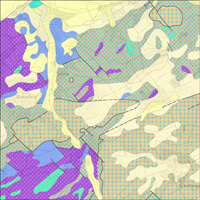
Die Geologische Übersichtskarte der Bundesrepublik Deutschland 1: 250 000 (GÜK250) ist eine blattschnittfreie Inselkarte und die digitale Nachfolgerin der Geologischen Übersichtskarte der Bundesrepublik Deutschland 1: 200 000 (GÜK200). Die GÜK250 bildet wie ihre Vorgängerin die oberflächennahe Geologie von Deutschland ab und beinhaltet harmonisierte und aktualisierte Informationen zum Alter, zur Zusammensetzung und zur Entstehung der Gesteine. Entsprechend dieser Inhalte bietet die GÜK250 drei bundesweite Legenden für die Darstellung der geologischen Einheiten an: a) Chronostratigraphie, b) Petrographie und c) Petrogenese. Weiterhin enthält die GÜK250 Informationen zur Lithostratigraphie, zum Bildungsprozess, -raum sowie -milieu der Gesteine. Zusätzlich liefert die GÜK250 – falls vorhanden – Mächtigkeitsangaben zu den geologischen Einheiten und enthält Layer mit tektonischen Linienelementen, Eisrandlagen sowie Quarzgängen. Generell bezieht sich der Begriff „oberflächennahe Geologie“ auf geologische Bildungen bis zur einer Tiefe von 2 m. Von diesem Darstellungskonzept wird aber – vor allem im Süden von Deutschland – z.T. deutlich abgewichen, sodass Gesteinsmächtigkeiten von bis zu mehreren 100 m auftreten können. Zudem gibt es in der GÜK250 neben dem Basislayer einen Überlagerungslayer, der i.d.R. geringmächtige quartäre Deckschichten beinhaltet. The General Geological Map of the Federal Republic of Germany 1:250,000 (GÜK250) is a seamless “Inselkarte” and the digital follower of the General Geological Map of the Federal Republic of Germany 1:200,000 (GÜK200). Like its predecessor, the GÜK250 represents the surface geology of Germany and contains harmonised and updated information on age, composition and genesis of the rocks. According to this content, the GÜK250 offers three nationwide legends for the portrayal of the geologic units: a) chronostratigraphy, b) petrography and c) petrogenesis. Furthermore, the new GÜK250 includes information on the lithostratigraphy, the genetic process as well as information on the physical and chemical environment of the rock formation. Additionally, the GÜK250 provides - if available - information on the thickness of the geologic units and contains layers which represent tectonic elements, marginal position of the ice shield and quartz dykes. In general, the term “surface geology” refers to geologic formations up to a depth of two meters. However, particularly in the south of Germany, considerable deviations of this concept exist and thicknesses of a couple of hundred meters may are displayed. The GÜK250 contains a base layer and an overlay layer which usually comprises thin Quaternary deposits.


